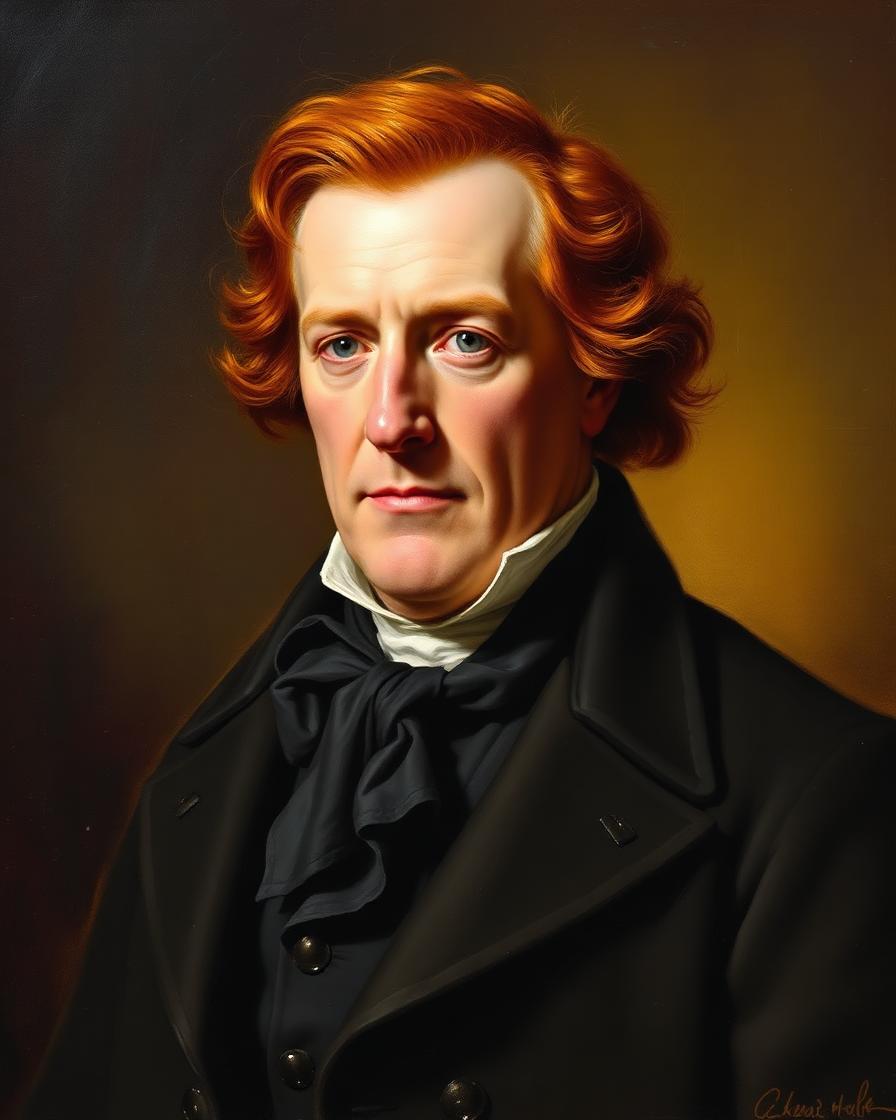
Quick Facts
- Years
- 1770 – 1838
- Category
- Explorers & Adventurers
- Nationality
- American
- Occupation
- Explorer & Cartographer
William Clark
1770 – 1838 · American · Explorer & Cartographer
Audiobook

Life Lessons from William Clark
Marcus Alden
Introduction
William Clark (August 1, 1770–September 1, 1838) was an American explorer, soldier, cartographer, territorial governor, diplomat, and administrator of Indigenous affairs. He is best known as the co-leader, with Meriwether Lewis, of the Lewis and Clark Expedition of 1804–1806—the first United States government-sponsored expedition to cross the continent to the Pacific Ocean and return.
Clark’s importance, however, extends well beyond that celebrated journey. A skilled frontiersman and mapmaker, he produced geographic records that transformed American knowledge of the West. He helped maintain discipline within the Corps of Discovery, negotiated with Native nations, supervised river travel, identified routes, and cared for the expedition’s practical needs. His partnership with Lewis became one of the most consequential collaborations in the history of North American exploration.
After the expedition, Clark became one of the most powerful federal officials west of the Mississippi River. He served as governor of Missouri Territory from 1813 to 1820 and as superintendent of Indian affairs at St. Louis from 1822 until his death. In those positions, he negotiated dozens of treaties and shaped relations between the United States and Indigenous peoples during an era of rapid territorial expansion.
Clark’s career therefore carries a complicated legacy. His journals and maps enlarged scientific and geographic understanding, yet his later policies assisted the dispossession and removal of Native communities. He was also a slaveholder, and his treatment of York—the enslaved man who accompanied him across the continent—stands in sharp contrast to the expedition’s reputation as a shared national adventure. William Clark remains both a central architect of American expansion and a figure whose life reveals its human costs.
Quick Facts
| Category | Details |
|---|---|
| Full name | William Clark |
| Born | August 1, 1770 |
| Birthplace | Caroline County, Colony of Virginia, British America |
| Died | September 1, 1838 |
| Place of death | St. Louis, Missouri, United States |
| Parents | John Clark III and Ann Rogers Clark |
| Siblings | One of ten children; younger brother of Revolutionary War commander George Rogers Clark |
| Known for | Co-leading the Lewis and Clark Expedition |
| Expedition role | Co-commander, mapmaker, negotiator, field leader, and journal keeper |
| Military service | Kentucky militia and United States Army |
| Major public offices | Governor of Missouri Territory; U.S. agent and superintendent of Indian affairs |
| Spouses | Julia Hancock; later Harriet Kennerly Radford |
| Children | Seven, though several died young |
| Enslaved attendant | York, who participated in the entire Lewis and Clark Expedition |
| Famous inscription | Clark carved his name and the date July 25, 1806, at Pompeys Pillar in present-day Montana |
| Burial place | Bellefontaine Cemetery, St. Louis, Missouri |
Early Life & Background
William Clark was born on August 1, 1770, in Caroline County, Virginia. He was the ninth of ten children born to John Clark III and Ann Rogers Clark, members of a Virginia planter family. The Clarks owned land and enslaved people, placing William within the social and economic world of the colonial and early national slaveholding elite.
Several of Clark’s older brothers served in the American Revolution. The most famous, George Rogers Clark, led American forces in the Illinois Country and captured British posts at Kaskaskia, Cahokia, and Vincennes. His campaigns helped secure American claims to the trans-Appalachian West. William grew up admiring George, whose military career and knowledge of frontier warfare strongly influenced him.
Clark received little formal schooling. His surviving journals reveal unconventional spelling and punctuation, but they also demonstrate close observation, practical intelligence, and an ability to record geographic, environmental, and diplomatic information. His limitations as a conventional writer did not prevent him from becoming an accomplished surveyor and mapmaker.
In the mid-1780s, the Clark family moved west to Kentucky, settling at Mulberry Hill near Louisville. Kentucky was then a borderland marked by migration, disputed land claims, and violence among settlers, Native nations, militias, and imperial powers. Clark learned to navigate forests and rivers, hunt, survey land, command small groups, and survive under frontier conditions.
In 1789, he joined a Kentucky militia expedition. Three years later, he entered the regular United States Army during the conflict commonly known as the Northwest Indian War. American forces were attempting to impose U.S. control over the Ohio Country, while a confederation of Native nations resisted the loss of their lands.
Clark became a lieutenant and served under General Anthony Wayne. He participated in campaigning that culminated in the American victory at the Battle of Fallen Timbers on August 20, 1794. During this period, Meriwether Lewis briefly served under Clark’s command. The two men developed the trust that later made their transcontinental partnership possible.
Poor health and family responsibilities led Clark to resign his commission in 1796. He returned to the family’s Kentucky properties, where he managed land, debts, and enslaved labor while remaining connected to military and political circles.
Rise to Prominence
The event that transformed Clark’s life began with President Thomas Jefferson’s long-standing interest in western geography and transcontinental commerce. After the Louisiana Purchase of 1803, Jefferson commissioned Meriwether Lewis to lead an expedition from the Mississippi Valley to the Pacific. Its objectives included mapping the region, studying plants and animals, seeking practical transportation routes, establishing relations with Native nations, and strengthening the United States’ claims against British and Spanish rivals.
Lewis needed a co-commander with frontier experience, military judgment, and skills in surveying and river travel. On June 19, 1803, he wrote to Clark inviting him to share command of the expedition. Clark accepted.
Lewis requested that Clark receive the rank of captain, but the War Department appointed him only a second lieutenant. To avoid undermining his authority, Lewis concealed the discrepancy from most members of the Corps of Discovery and treated Clark publicly as an equal-ranking captain. Their shared command was unusual, but it worked remarkably well. Lewis often concentrated on natural history, diplomacy, and planning, while Clark supervised travel, mapped routes, managed camps, and maintained daily relations with the men.
Clark joined preparations near Louisville in October 1803 and helped recruit able frontiersmen, soldiers, hunters, and boatmen. The expedition established its winter camp at Camp Dubois, near the mouth of the Missouri River, in present-day Illinois. Clark oversaw much of the training and discipline there while Lewis conducted business in St. Louis.
The Corps of Discovery departed Camp Dubois on May 14, 1804. Lewis joined the group at St. Charles, and the expedition proceeded up the Missouri River. The journey required the men to row, pole, sail, and tow their vessels against a powerful current. Clark’s experience in handling boats and men proved essential.
The expedition’s first months also revealed the diplomatic complexity of its mission. The United States claimed sovereignty over lands occupied by numerous independent Native nations, many of which had established commercial and political relationships with Britain, France, or Spain. Lewis and Clark distributed medals, flags, uniforms, and speeches proclaiming American authority, but Indigenous leaders interpreted these encounters according to their own political interests.
Clark’s rise to national prominence was therefore rooted not in a single discovery, but in his effectiveness as a practical commander. He became the expedition’s principal cartographer, producing route maps and geographic observations of extraordinary value.
Major Achievements
Clark’s foremost achievement was helping lead the Corps of Discovery across North America and back without losing the expedition to starvation, conflict, accident, or disintegration. Only one member, Sergeant Charles Floyd, died during the journey, apparently from a ruptured appendix—an unusually low mortality rate for such an undertaking.
During the winter of 1804–1805, the expedition built Fort Mandan near present-day Washburn, North Dakota. There Lewis and Clark met Toussaint Charbonneau, a French Canadian trader, and Sacagawea, his young Lemhi Shoshone wife. They engaged Charbonneau as an interpreter. Sacagawea traveled with the expedition while carrying her infant son, Jean Baptiste Charbonneau, whom Clark nicknamed “Pomp” or “Pompy.”
Clark became one of the expedition’s principal mapmakers. Using compass bearings, estimated distances, celestial observations, and information supplied by Native guides and leaders, he created a remarkably detailed representation of western rivers, mountains, settlements, and travel routes. His final map corrected major misconceptions, especially the belief that a short and easy portage connected the Missouri and Columbia river systems.
In 1805, the expedition crossed the northern Rocky Mountains with horses obtained from the Shoshone. The difficult passage through the Bitterroot Mountains brought the Corps close to starvation. Assistance from the Nez Perce helped save the expedition. The party then descended the Clearwater, Snake, and Columbia rivers toward the Pacific.
The Corps reached the Pacific coast region in November 1805 and built Fort Clatsop near present-day Astoria, Oregon. Clark’s November 7 journal entry, “Ocian in view! O! the joy,” became one of the expedition’s best-known lines, although the party was then viewing the Columbia estuary rather than the open ocean.
Clark also participated in the decision over where to spend the winter. Members of the expedition, including York and Sacagawea, were asked for their preferences. This episode is sometimes described as a democratic vote, although it was not a formal election and Lewis and Clark retained final authority. Even so, the recorded consultation is notable because an enslaved Black man and an Indigenous woman expressed their views within a U.S. military expedition decades before either group possessed political rights in the United States.
On the return journey in 1806, the Corps divided to explore additional territory. Clark led a party through the Yellowstone River region. On July 25, he climbed a prominent sandstone formation that he named “Pompy’s Tower” after Sacagawea’s son. Now called Pompeys Pillar, the site preserves Clark’s carved signature and date—the only surviving physical inscription along the expedition route generally accepted as having been made by either commander.
The expedition returned to St. Louis on September 23, 1806. Its members had been presumed dead by many people in the United States. Their arrival produced public celebration, and Clark received double pay and a land grant of 1,600 acres.
Clark’s achievements continued after the journey. He helped organize the expedition’s records after Lewis’s death in 1809 and cooperated with Nicholas Biddle in preparing the official narrative published in 1814. Clark’s geographic work formed the basis of the expedition’s authoritative map, which greatly improved American knowledge of the trans-Mississippi West.
Defining Moments
One defining moment in Clark’s career was his acceptance of Lewis’s invitation in 1803. Clark was older, had once been Lewis’s commanding officer, and had resigned from the Army years earlier. His willingness to accept technically inferior military rank while functioning as an equal commander demonstrated both personal confidence and commitment to the mission.
Another occurred in August 1804, when Sergeant Charles Floyd became gravely ill near present-day Sioux City, Iowa. Despite the commanders’ efforts, Floyd died on August 20. Clark carefully recorded the death, and the Corps buried Floyd on a bluff overlooking the Missouri. The loss emphasized the expedition’s isolation and the limited medical knowledge available to its leaders.
The crossing of the Bitterroot Mountains in September 1805 tested Clark’s endurance and judgment. Deep snow, exhausted horses, scarce game, and inadequate food reduced the men to eating portable soup, candles, and some of their horses. Clark moved ahead with hunters in search of food and contact with Native communities. The expedition’s survival depended heavily on the aid of the Nez Perce.
The arrival in the Pacific watershed was emotionally significant, but the winter at Fort Clatsop proved miserable. Persistent rain damaged clothing and supplies, fleas infested bedding, and the party’s diet became monotonous. Clark nevertheless continued mapping, recording weather, and compiling information.
During the return journey, Clark’s exploration of the Yellowstone added substantial geographic knowledge. His inscription at Pompeys Pillar became an enduring material link to the expedition. Nearby, he recorded Indigenous pictographs and surveyed the surrounding landscape.
The death of Meriwether Lewis in Tennessee on October 11, 1809, was another turning point. Lewis died from gunshot wounds at Grinder’s Stand on the Natchez Trace. His death was officially treated as suicide, although murder theories have persisted. Clark accepted the conclusion that Lewis had taken his own life and helped preserve his friend’s reputation and papers.
Clark’s defeat in Missouri’s first gubernatorial election in 1820 also redirected his career. Although he lost to Alexander McNair, he remained deeply involved in federal Indian affairs. In that sphere, his authority eventually extended across a vast portion of the western United States.
Timeline
| Year | Event |
|---|---|
| 1770 | Born on August 1 in Caroline County, Virginia |
| 1785 | Clark family relocates to the Kentucky frontier |
| 1789 | Joins the Kentucky militia |
| 1792 | Commissioned in the United States Army |
| 1794 | Serves in the campaign culminating in the Battle of Fallen Timbers |
| 1795–1796 | Commands a rifle company in which Meriwether Lewis serves |
| 1796 | Resigns from the Army because of poor health and family obligations |
| 1803 | Accepts Lewis’s invitation to co-lead a western expedition |
| 1804 | Corps of Discovery leaves Camp Dubois on May 14; Sergeant Floyd dies August 20 |
| 1804–1805 | Winters at Fort Mandan near the Mandan and Hidatsa villages |
| 1805 | Crosses the Rocky Mountains and reaches the Columbia River estuary |
| 1805–1806 | Winters at Fort Clatsop near the Pacific coast |
| 1806 | Explores the Yellowstone; signs Pompeys Pillar; returns to St. Louis on September 23 |
| 1807 | Appointed principal U.S. agent for Indian affairs in the region and brigadier general of territorial militia |
| 1808 | Marries Julia Hancock |
| 1809 | Meriwether Lewis dies; Clark assumes an important role in preserving the expedition’s records |
| 1813 | Appointed governor of Missouri Territory |
| 1814 | Official expedition narrative and Clark-based map are published |
| 1820 | Loses Missouri’s first state gubernatorial election to Alexander McNair |
| 1821 | Marries Harriet Kennerly Radford after Julia’s death the previous year |
| 1822 | Becomes superintendent of Indian affairs at St. Louis |
| 1825 | Participates in major treaty councils at Prairie du Chien and elsewhere |
| 1831 | Harriet Clark dies |
| 1832 | Serves during the period of the Black Hawk War and expanding removal policy |
| 1838 | Dies in St. Louis on September 1 |
Personal Life
Clark married Julia Hancock on January 5, 1808. He had apparently named a river in her honor during the expedition, calling it “Judith’s River”; it is now the Judith River in Montana. The couple had five children: Meriwether Lewis Clark, William Preston Clark, Mary Margaret Clark, George Rogers Hancock Clark, and John Julius Clark. Several died before reaching full adulthood.
Julia died in 1820. In 1821, Clark married her cousin Harriet Kennerly Radford, a widow with children from her previous marriage. Clark and Harriet had two sons, Jefferson Kearny Clark and Edmund Clark; Edmund died in infancy. Harriet died in 1831.
Clark developed a strong attachment to Sacagawea’s son, Jean Baptiste Charbonneau. After the expedition, he offered to oversee the child’s education in St. Louis. Jean Baptiste later traveled in Europe, worked as a guide and trader, and participated in the California Gold Rush. Clark also showed concern for Jean Baptiste’s younger sister, Lisette, though the details of her short life remain uncertain. Claims that Clark formally adopted both children are common, but the documentary evidence is less conclusive than the popular story suggests.
Clark’s family life was supported by enslaved labor. The best-known person he enslaved was York, who had probably been assigned to Clark as a young man and accompanied him throughout the expedition. York hunted, carried supplies, cared for the ill, and participated in diplomatic encounters. His size, skin color, and physical confidence attracted intense interest among Native communities that had little or no previous contact with people of African descent.
After returning east, York sought freedom and wished to live with his wife, who was enslaved by another owner. Clark initially refused. The date and circumstances of York’s eventual emancipation remain uncertain, and later accounts are contradictory. Clark’s behavior toward York remains one of the most troubling aspects of his private life.
Beliefs & Philosophy
Clark left no systematic statement of political or moral philosophy. His beliefs must be reconstructed from his journals, correspondence, official actions, and social position.
He valued courage, endurance, loyalty, practical knowledge, and disciplined cooperation. His command style was generally steadier and more approachable than Lewis’s, and expedition members appear to have respected his judgment. He often expressed concern for sick or injured companions and formed lasting bonds with several members of the Corps.
Clark also shared the expansionist assumptions of the early United States. He believed that western lands could be mapped, claimed, commercially developed, and incorporated into the republic. Like Jefferson and many contemporaries, he assumed that Native nations would have to accommodate American sovereignty, trade systems, farming practices, and settlement.
His writings show genuine curiosity about Indigenous languages, customs, geography, and political structures. He could respect individual Native leaders and seek peaceful diplomacy. Yet respect and paternalism existed side by side. Clark frequently treated Indigenous nations as dependent “children” of the federal government rather than as fully sovereign peoples.
His ownership of enslaved people likewise reflected both personal choice and the racial hierarchy of the society in which he was raised. York’s indispensable service did not persuade Clark to grant him immediate freedom. Clark’s life therefore illustrates how admirable qualities such as bravery, loyalty, and scientific curiosity could coexist with participation in slavery and colonial expansion.
Challenges & Controversies
The expedition itself presented enormous physical challenges. The Corps traveled thousands of miles through unfamiliar terrain, endured extreme heat and cold, faced hunger and disease, crossed dangerous rivers and mountains, and depended on uncertain supplies. Clark’s maps were created without modern instruments, reliable longitude measurements, or standardized geographic data.
Diplomacy posed another challenge. Lewis and Clark told Native leaders that the United States now governed Louisiana, but such proclamations had little immediate meaning to nations that controlled their own territories. Encounters with the Lakota near the Bad River in September 1804 nearly became violent. Other relationships, including those with the Mandan, Hidatsa, Shoshone, Nez Perce, Clatsop, and Chinook peoples, involved negotiation, misunderstanding, trade, and mutual dependence.
Modern scholarship has challenged the older portrayal of the Corps as discovering an empty wilderness. The expedition crossed inhabited homelands connected by extensive Indigenous trade routes. Native people provided geographic information, horses, food, shelter, interpretation, and guidance. Without this assistance, Lewis and Clark might not have survived.
Clark’s treatment of York is a central controversy. During the expedition, York possessed an unusual degree of mobility and responsibility. On returning, however, he remained legally enslaved. Clark wrote years later that York had become dissatisfied and difficult after experiencing freedom on the journey. He reportedly hired York out and may have subjected him to harsh treatment. Washington Irving later recorded Clark’s claim that he freed York, who then failed in business and regretted freedom. Historians treat this paternalistic account cautiously because it comes through Clark and reflects common proslavery arguments. York’s final years and death remain uncertain.
Clark’s long administration of Indian affairs is equally complex. He negotiated or participated in treaties involving the Osage, Sauk, Meskwaki, Iowa, Otoe, Missouri, Omaha, Ponca, Kansa, and other nations. These agreements were often made under severe imbalances of power and transferred vast territories to the United States. Clark sometimes attempted to prevent violence, regulate traders, distribute aid, or protect Native delegates. Nevertheless, the system he administered advanced land cessions, dependency, confinement, and removal.
As governor, Clark also supported the United States during the War of 1812, when conflict spread through the Mississippi Valley. American officials often interpreted Native resistance as evidence of British manipulation while minimizing Indigenous efforts to defend territory and political autonomy.
Even Clark’s cartographic achievement served expansion. His maps made the West more legible to federal officials, soldiers, traders, and settlers. Knowledge that was scientifically valuable also became an instrument of conquest.
Famous Quotes
Clark’s journals preserve his original spelling, capitalization, and punctuation. Wording varies slightly among scholarly transcriptions.
“Ocian in view! O! the joy.”
—Journal entry for November 7, 1805, written as the expedition approached the Columbia River estuary.
“This rock which I shall Call Pompy’s Tower is 200 feet high and 400 paces in secumphrance.”
—Journal entry for July 25, 1806, describing the formation now known as Pompeys Pillar.
“Your woman who accompanied you that long dangerous and fatigueing rout to the Pacific Ocian and back diserved a greater reward for her attention and services on that rout than we had in our power to give her.”
—Clark to Toussaint Charbonneau, August 20, 1806, acknowledging Sacagawea’s contribution.
“I offered to take your little son a butifull promising child who is 19 months old to which you agreed.”
—Clark to Charbonneau, August 20, 1806, referring to Jean Baptiste Charbonneau.
These lines are revealing not only for their content but for Clark’s direct, phonetic writing style. His spelling was irregular, yet his journals conveyed immediacy and detailed observation.
Legacy & Influence
William Clark’s most visible legacy is the Lewis and Clark Expedition. Its journals documented plants, animals, landscapes, waterways, Native nations, and commercial possibilities across a vast region. Clark’s maps remained influential for years and helped replace speculation with a more accurate understanding of western geography.
His leadership also contributed to the expedition’s extraordinary cohesion. Lewis and Clark possessed different temperaments and abilities, but their cooperation allowed the Corps to function under prolonged stress. Clark’s field management, river knowledge, mapmaking, and relationships with expedition members were central to its success.
Places bearing his name include Clark County in several states, the Clark Fork River, and numerous schools, towns, roads, and institutions. The Lewis and Clark National Historic Trail follows approximately 4,900 miles through sixteen states. Pompeys Pillar preserves his 1806 signature.
Yet Clark’s legacy cannot be separated from the consequences of U.S. expansion. The routes he mapped opened lands already inhabited by Native peoples to traders, soldiers, settlers, and federal officials. As superintendent of Indian affairs, he became a leading administrator of the treaty system through which Indigenous nations lost millions of acres.
His relationship with York has also reshaped public interpretation of the expedition. York is now recognized not as a servant at the edge of the story, but as a full participant whose labor and endurance were indispensable. Similarly, Sacagawea and the Native communities that aided the Corps are increasingly presented as historical actors rather than supporting characters in a story of white exploration.
Clark’s enduring significance lies in this combination of achievement and contradiction. He was an exceptional explorer and cartographer, a capable public servant, a slaveholder, and an agent of settler colonialism. A complete assessment must hold all of these truths together.
Interesting Facts
- Clark was four years older than Meriwether Lewis and had previously served as his military superior.
- Although popularly called “Captain Clark,” his official expedition rank was second lieutenant; Lewis treated him as an equal captain.
- Clark’s spelling was highly phonetic, but his maps and geographic observations were sophisticated.
- He named “Judith’s River” for Julia Hancock, whom he later married.
- Clark nicknamed Jean Baptiste Charbonneau “Pomp,” inspiring the original name “Pompy’s Tower.”
- His signature at Pompeys Pillar is the expedition’s best-known surviving on-site inscription.
- Clark estimated distances by counting his steps, timing travel, and observing compass bearings.
- He was primarily responsible for many of the expedition’s route maps.
- The Corps carried Clark’s enslaved attendant York to the Pacific and back, making York the first known Black man to cross North America north of Mexico and reach the Pacific coast.
- Clark helped arrange the publication of the expedition journals after Lewis’s death.
- He served as Missouri territorial governor under Presidents James Madison and James Monroe.
- His St. Louis office became a major diplomatic center where delegations from western Native nations met federal representatives.
- Several of Clark’s children were named for relatives or expedition associates, including Meriwether Lewis.
- Clark died at the home of his eldest son, Meriwether Lewis Clark, in St. Louis.
- He was initially buried on family property and later reinterred at Bellefontaine Cemetery.
Frequently Asked Questions
What was William Clark best known for?
Clark was best known for co-commanding the Lewis and Clark Expedition from 1804 to 1806. He also created many of its most important maps and later served as governor of Missouri Territory and superintendent of Indian affairs.
Were Lewis and Clark equal commanders?
In practice, yes. Lewis intended Clark to be his equal and presented him as a captain. Officially, however, the War Department commissioned Clark as a second lieutenant. The rank discrepancy was largely concealed from the expedition’s members.
What skills did Clark bring to the expedition?
Clark brought military experience, frontier survival skills, river knowledge, surveying ability, mapmaking expertise, and practical leadership. He was particularly effective at supervising camps, organizing travel, and maintaining morale.
Did William Clark discover the Pacific Ocean?
No. Indigenous peoples had lived along the Pacific coast for thousands of years, and European and American mariners had already explored parts of it. The Corps of Discovery was the first U.S. government expedition to travel overland from the Mississippi watershed to the Pacific and return.
What was Clark’s relationship with Sacagawea?
Clark respected Sacagawea’s contribution and praised her service. He became fond of her son, Jean Baptiste, and later helped arrange the boy’s education. Their relationship should not obscure the unequal social and political conditions surrounding the expedition.
Did William Clark free York?
York eventually appears to have gained freedom, but the date and circumstances are disputed. Clark initially refused York’s requests for emancipation after the expedition. Later accounts claiming that York regretted freedom are unverified and shaped by Clark’s paternalistic perspective.
Why is William Clark controversial?
Clark enslaved people, resisted York’s demand for freedom, and administered treaties that enabled the United States to acquire Indigenous lands. His scientific and geographic achievements were substantial, but they also facilitated settlement and Native dispossession.
What happened to Clark after the expedition?
He became a militia general and federal agent for Indian affairs in 1807, governor of Missouri Territory in 1813, and superintendent of Indian affairs in 1822. He remained a major western official until his death in 1838.
Where is William Clark’s original signature?
Clark’s carved signature and the date July 25, 1806, survive at Pompeys Pillar National Monument in Montana. A protective structure now helps preserve the inscription.
How did William Clark die?
Clark died in St. Louis on September 1, 1838, at age sixty-eight. He had experienced declining health and spent his final period at the home of his eldest son.
Lessons from William Clark
- Complementary leadership can be powerful. Clark and Lewis succeeded partly because their practical and intellectual strengths balanced one another.
- Detailed observation has lasting value. Clark’s maps and journals transformed a difficult journey into a permanent body of geographic knowledge.
- Survival often depends on cooperation. The expedition relied on its members and on the knowledge, food, horses, and guidance supplied by Native peoples.
- Education is broader than formal schooling. Clark had limited classroom instruction but developed advanced practical expertise in surveying, navigation, and command.
- Historical achievement does not erase moral responsibility. Clark’s exploration must be considered alongside his slaveholding and role in Indigenous dispossession.
- Popular stories should be reexamined. The expedition was not a journey through empty land; it crossed sovereign and densely connected Indigenous worlds.
- Credit should include overlooked participants. York, Sacagawea, Native guides, interpreters, hunters, soldiers, and boatmen all contributed to the mission.
- Maps are never entirely neutral. Clark’s cartography expanded knowledge, but it also helped governments and settlers claim and occupy territory.
- Leadership is judged by what follows success. Clark’s conduct after the expedition, especially toward York and Native nations, is essential to evaluating his character.
- Complexity strengthens historical understanding. Clark can be recognized as a gifted explorer without turning him into an uncomplicated hero.
Further Reading
- Stephen E. Ambrose, Undaunted Courage: Meriwether Lewis, Thomas Jefferson, and the Opening of the American West.
- James P. Ronda, Lewis and Clark Among the Indians.
- William E. Foley, Wilderness Journey: The Life of William Clark.
- Landon Y. Jones, William Clark and the Shaping of the West.
- Gary E. Moulton, ed., The Journals of the Lewis and Clark Expedition.
- Donald Jackson, ed., Letters of the Lewis and Clark Expedition with Related Documents, 1783–1854.
- Dayton Duncan and Ken Burns, Lewis & Clark: The Journey of the Corps of Discovery.
- National Park Service, Lewis and Clark National Historic Trail resources.
- National Park Service, Pompeys Pillar National Monument historical materials.
- Missouri History Museum collections on William Clark, territorial Missouri, and western Indian affairs.
Watch and Learn
Related Historical Figures